Sierra South has complied our favorite Kern River Hiking Trails to make your next hike an easy choice!
1. Valhalla Falls on Salmon Creek
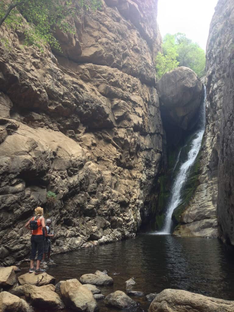
Valhalla Falls is a hidden gem within the Sequoia National Forest. The beautiful 60-foot waterfall is nestled in a deep granite gorge with crystal clear water and a nice pool that allows you to swim right to the base of the falls. Temperatures at the falls can be up to 30 degrees cooler than on the hike which makes this a summertime favorite. This hike requires sturdy shoes and a moderately challenging scramble.
Distance: 1.5 miles
Trailhead: https://goo.gl/maps/KhLDoZx1jaHAJt1D9
2. Trail of 100 Giants
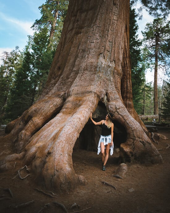
The Trail of 100 Giants is one of the most famous hiking trails in California. This infamous loop takes you right through the heart of one of the biggest Giant Sequoia groves in the world and allows you to be right up and personal with the largest trees in the world. This trail is accessible Spring through Fall and is good for all skills and ages.
Distance: 1.3 miles
Trailhead: https://goo.gl/maps/aZmwPQbbbJhAq6UG9
3. Sherman Peak

The hike to Sherman Peak is the perfect summertime trek. At nearly 10,000 feet in elevation, this trail gives you unparalleled views into the Kern Trench. From the top, you can see the Lower 48’s tallest mountain Mt. Whitney as well as all the other prominent peaks in the Kern River drainage. This hike has close to a 1000ft elevation gain so plan for a challenging hike and be prepared for all instances that can occur in the wilderness.
Distance: 5 Miles roundtrip
Trailhead: https://goo.gl/maps/Df3AxTUM6R3bvM6p7
4. River Trail
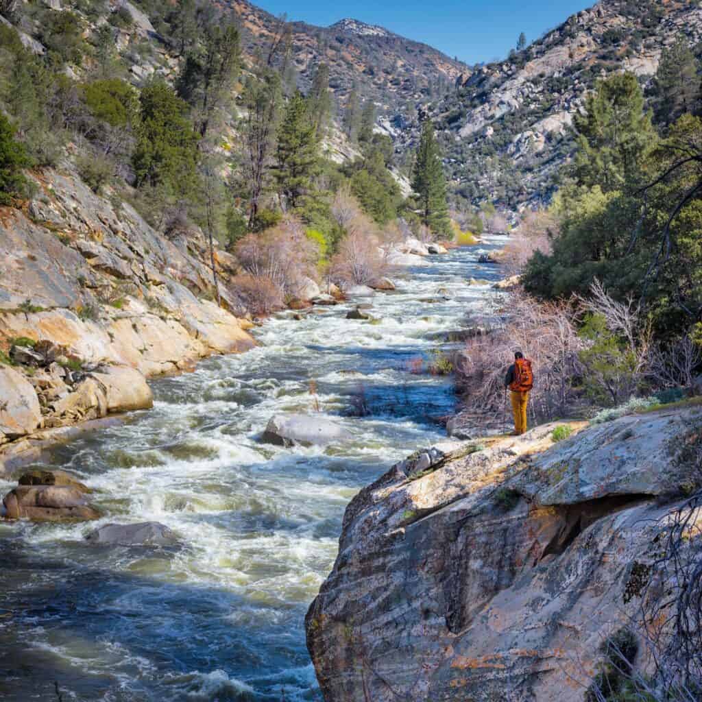
The River Trail is an easy to moderate hike that takes you up the last 4 miles of the Forks of the Kern. This part of the Kern River is filled with beautiful wildflowers, steep granite walls, and a stunning view of the river the entire way. The trail is accessible year round.
Distance: 5.1 miles
Trailhead: https://goo.gl/maps/q3VXmnSTSRdavtVM6
5. Packsaddle Cave
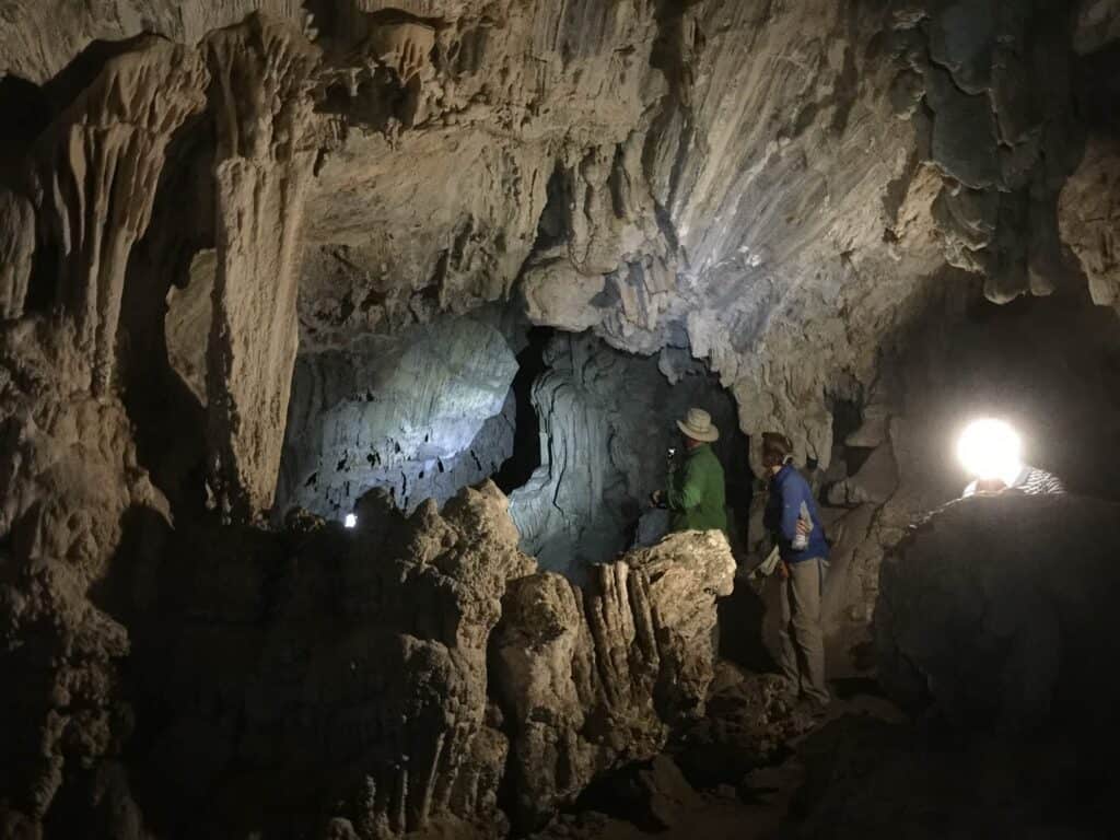
This dramatic cave is one of the most unique hiking destinations in the Kern River Valley. The cave is very large and has beautiful limestone rock formations. This trail is rated moderate to difficult. A flashlight or headlamp is necessary to enter the cave. Moisture can be prevalent inside the cave and temperatures are much lower than on the hike. Plan accordingly.
Distance: 5 miles roundtrip
Trailhead: https://goo.gl/maps/pCjvhpPBjyqTHsj39
6. Powers Peak
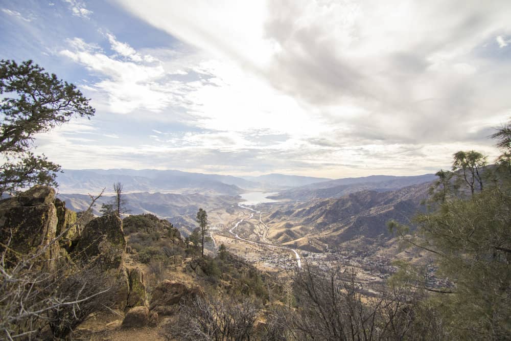
Powers Peak is a locals favorite during the spring, fall, and winter. This moderate to difficult trail is just minutes outside of Kernville and rewards you with an incredible view of town and Lake Isabella. The first 4 miles of the trail is a steady uphill climb and the last mile to the summit is a steep and difficult scramble.
Distance: 10 miles roundtrip
Trailhead: https://goo.gl/maps/MbeUobszU6qz1raS7
7. Baker Peak Lookout Tower
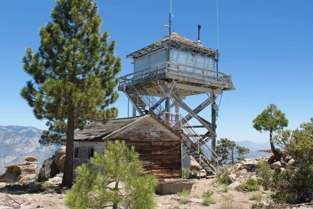
Baker Peak is the mountain that overlooks Kernville directly to the north. This easy to moderate hike takes you to a decommissioned USFS fire lookout tower and provides incredible 360 degree views of Lake Isabella, Kernville, Sherman Peak, the Needles, Dome Rock and the entire Upper Kern RIver drainage. High winds can be experienced while visiting Baker Peak.
Distance: 3 miles roundtrip
Trailhead: https://goo.gl/maps/MaPdRVLguMiLcrue7

 760-376-3745
 Help Me Choose a Rafting Trip